

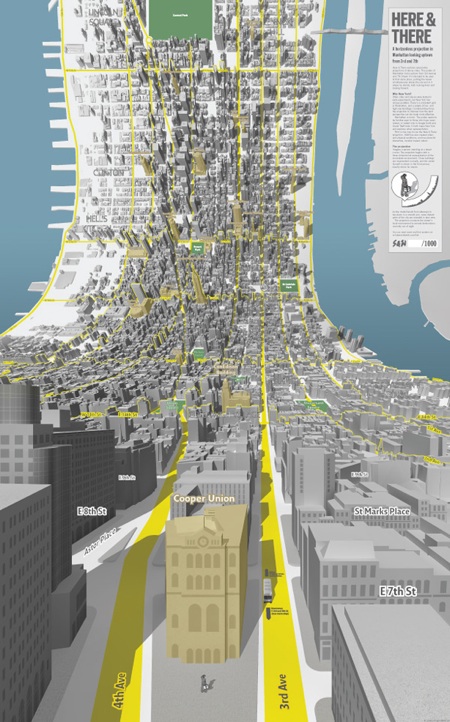
Bendy Map Projection
It’s not often a new kind of map perspective is invented, but this one by Schulze & Webb looks new to me. It’s an ingenious blend of 3D and overhead orthogonal. The “bent” perspective is wonderfully intuitive. Their map of Manhattan is static, printed, and meant to be “poured over.” But the cartographic view wants to be dynamic, interactive, and generated on the fly as you scroll around. Let’s hope Google Maps et al pick up the concept. (Via Kottke)
This site operates under a Creative Commons License.