

The Average Place on Earth
[Translations: Chinese, Japanese]
Technology and human activity are so global that they operate together as if they were a geological force. Civilization is altering the climate in the same way that volcanoes do and have done; our agriculture alters the biosphere the way climate has in the past; and now megacities are altering the planetary balances of heat and sea level. The technium is a planetary event.
I describe this global system of technology deployed around the planet as an emerging superorganism. It consists of roads, electric lines, telephone cables, buildings, water systems, dams, satellites, ocean buoys and ships, all our computers and data centers, and all 6 billion humans. But while this superorganism of new and old technology operates at the planetary scale, and reaches all continents, and spans the oceans, and reaches into orbital space, it is a thin and uneven layer on the globe. In fact most of the planet, on average, is in a very primitive state.
Let’s draw a grid around the globe with lines that form a square approximately every 100 km (at the equator). At every intersection of these grid lines we’ll take a picture for inspection.
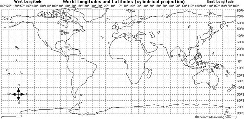
There are about 10,000 intersections over the land part of this planet. They will give us a very good statistical portrait of what this planet looks like on land.
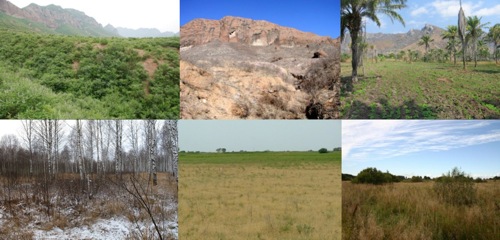
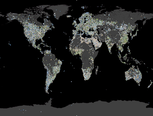 Shown are 6,000 images of a possible 10,000 degree intersections on land.
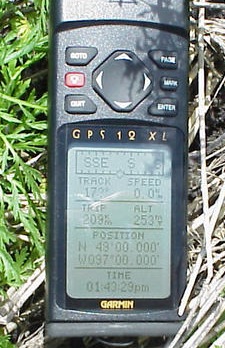
The imaginary grid is the longitude and latitude grid, and somewhat remarkably, over 6,000 of the 10,000 intersections have already been photographed. Intrepid volunteers sign up at a web site called the Degree Confluence that is half art-project, and half adventure storytelling in order to select an intersection somewhere on the globe to visit –no matter how wild — and record their success with photographs including a legible snapshot of their gps proving a bonafide “even” lat-long reading with lots of zeros.
The resultant grid of photos is very revealing (below). Here is a portion of southern China, one of the most densely settled regions on the planet. Each image is one degree intersection. There is hardly a building in site. And for a place that has been intensely farmed for centuries if not millennia, there is a surprising lot of wildness. What it does to show is urbanization.
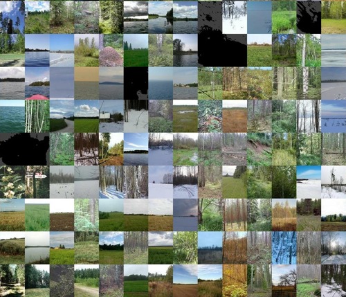
If we take a random 6 images from the database, we get an even more randomized view of what the planet looks like on average (on land). Here even agriculture is absent. On average the force of the technium is indirect. On average, Earth is rural and wild. Not a virgin, uninterrupted wild, but an un-urbanized rural place. The great work of the cities and megacities are relegated to thin neuronal clusters.
Projections for the year 2050 predict that most of the 8 billion people on the planet will live in megacities, with populations over 30 million. And these megacity clusters will form a network made up of smaller cities over 1 million in population. But these incredibly dense clusters will weave through a countryside that is emptying. It is already common to find entire villages in China, India, and South America abandoned by its inhabitants who fled to the swelling cities, leaving behind a few old folks, or often, no one at all.
This is the pattern on Earth. Extremely dense and vast populations in a network of megacities connected to each other with nerves of roads and wires, woven over an empty landscape of wild land, marginal pastures, and lightly populated farms.
By 2050 and beyond, Earth will be a urban planet, while the average place on the planet will be nearly wild.
