Clouds
Tools for Possibilities: issue no. 38
Once a week we’ll send out a page from Cool Tools: A Catalog of Possibilities. The tools might be outdated or obsolete, but the possibilities they inspire are new. Sign up here to get Tools for Possibilities a week early in your inbox.
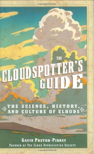
Clearest guide to clouds
If weather is your religion, this book is good news. It’s the best cloud identification guide I’ve seen. It’s excellence comes in part because great photos of each cloud species have been selected from the world-wide fan club for clouds called the Cloud Appreciation Society. (They also have a great online gallery of unusual cloud photos.) Additional goodness stems from the enthusiastic, clear and lyrical descriptions of the author, who is Chief Cloud Appreciator. Better than anyone else, he’s made the reasons behind cloud differences clear to me. I’ve become more of a cloud connoisseur, able to read the weather a bit better. Finally much of the charm of this book comes from its handsome presentation; the welcoming design is a throwback to an earlier era of bookmaking with clear tables and clear figures.
In short, this is the clearest guide to clouds I’ve encountered. —KK
- We pledge to fight ‘blue-sky thinking’ wherever we find it. Life would be dull if we had to look up at cloudless monotony day after day. We seek to remind people that clouds are expressions of the atmosphere’s moods, and can be read like those of a person’s countenance.
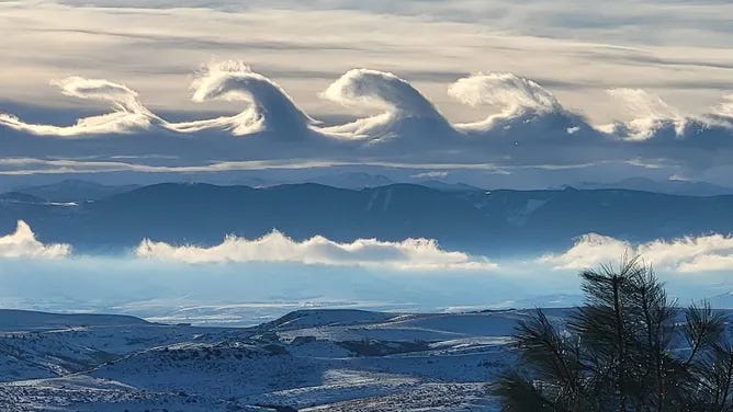
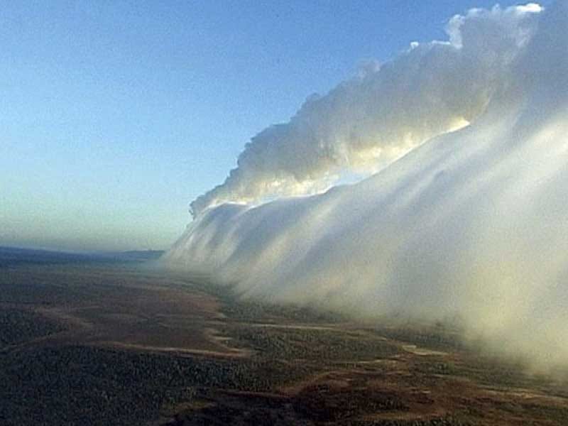
This rare Cirrus formation is known as a Kelvin-Helmholtz wave cloud and can form in the region between shearing winds, moving in different directions.
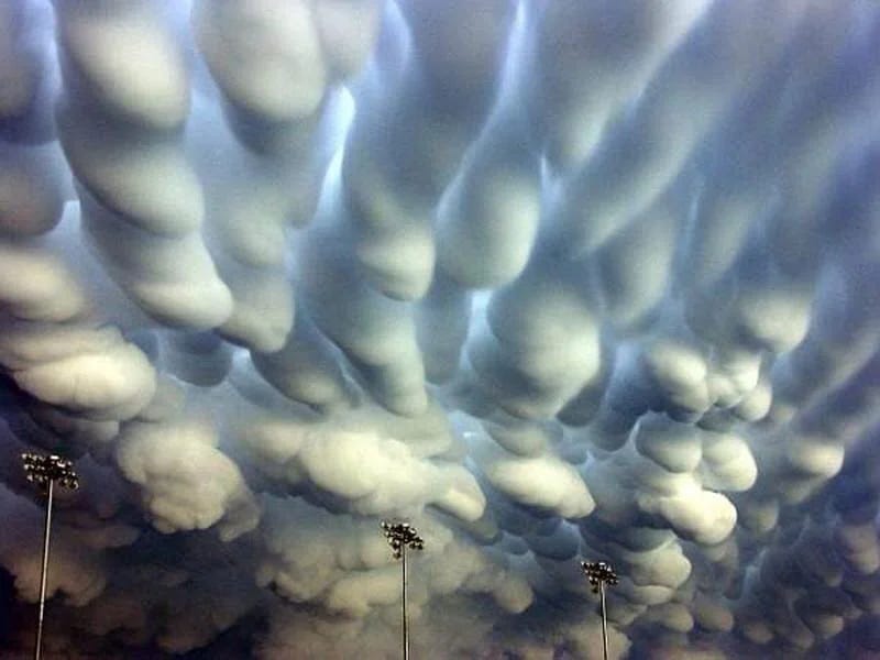
The mamma cloud formations, sometimes known as ‘mammatus’, are named after the Latin for ‘breasts’. As described earlier, these can appear on the underside of a number of different cloud types – Cirrus, Cirrocumulus, Altocumulus, Altostratus, Stratocumulus, and Cumulonimbus – and at their most dramatic look like a field of smooth, globular udders.
They are at their most impressive when wed to a mighty Cumulonimbus. Forming on the underside of its incus, mamma appear when the top of the anvil cools, by radiating heat up into the atmosphere, and parts of it sink into the air below. When this air is relatively warm and humid, some of its water vapour condenses into cloud droplets as it mixes with the cold air. The process is like the reverse of convection currents forming into Cumulus clouds: rather than air warming at the ground level and rising to forum clouds, here air is cooling at the top of the troposphere and sinking to form them.
Mamma tend to be far less dramatic on the other cloud types. On the whole they are only plump, full and abundant when there is a mighty thunderstorm in the vicinity. The more powerful the Cumulonimbus, the more buxom the mamma.
With a population of just 178, Burketown sits in one of Australia’s most remote shires. But every September and October, a small group of individuals journey from all corners of the country for the appearance of a remarkable and dramatic cloud called the Morning Glory. Clouds don’t usually have names, nor are they normally linked to a particular location, but then the Morning Glory is no normal cloud. Looking like a huge white roll of meringue, it stretches up to 600 miles (about the length of Britain) and sweeps over Burketown at speeds of up to 35mph. The visitors who come to marvel at this beautiful and awe-inspiring meteorological phenomenon are an intrepid group of glider pilots, for whom the cloud promises the most unique and thrilling flying conditions of anywhere in the world. Each year they come to this sleepy town in the hope of ‘soaring’ the Morning Glory, an exhilarating gliding adventure that can only be described as cloud-surfing.
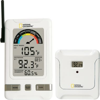
Wireless Thermometer With Comfort Level Reading
Indoor/Outdoor Humidex Thermometer
We plan activities around weather forecasts. However, the information is often from sensors far from our location. I want data from my backyard with the convenience of not having to go outside to read it. I have been using the wireless Indoor/Outdoor Humidex Thermometer for over two years. It is perfect for my needs. I have placed it in a central location in the house and I take a glance at the readings every time I pass it (at least ten times a day).
Setting it up is a snap. First insert two AA batteries into the back of the monitor and two more into the remote outside sensor. Press the reset button on both and you should begin receiving data which is displayed on the monitor. Look for a suitable place to locate the sensor. A shady area is recommended for accurate readings. The maximum transmission range is 45 meters but that is in open spaces. Walls will cut down on the separation distance. A signal detector icon indicates how strong the connection is between the two devices. Using this will help you find the best place to put each of the two gadgets. The remote sensor is splash proof but it should not be exposed to heavy rain. I have put mine under the eaves of my garage. The monitor can be mounted on a wall or placed on any flat surface.
This particular model is perfectly suited for cold Canadian weather. The remote temperature sensor is good for -50°C to 70°C (-58°F to 158°F). The main difference between this monitor and the competition is that this model provides decimal temperature readings, which is a rarity. A temperature of 16.6°C to 17.4°C would register as 17°C on most monitors. I appreciate this precision because I am sure I can tell the difference between these two readings. On the monitor there is a battery indicator icon, letting you know when the power is starting to go. The batteries should last about 12 months.
Besides the indoor/outdoor temperatures, the monitor also displays the outside humidity and a “Humidex” index to indicate how comfortable/uncomfortable the temperature really is outside. — Marcel Dufresne
06/12/23